|
|
||||
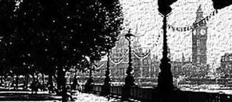
Simon Foxell, Mapping London: Making Sense of the City, Hardback, 288 pages, 300 b/w and colour ills, London: Black Dog Publishing, 2007. ISBN13: 978 1 906155 07 0. ú39.95
Steven Barfield
<1> Although there are short introductions to each of the main sections of this carefully produced and beautifully presented large format book, there is no doubt that it is the maps themselves that are the real and enduring stars here: 300 illustrations in 288 pages with over 200 maps spanning some six centuries. They shine alongside the skilful and ingenious cartographers who made them and tried to understand the patterns of the city that they saw and commented upon, or who imagined the city in its future manifestations, by means of this stunning array of two-dimensional representations.
<2> The book is therefore something of a celebration of how London has been represented through a wide variety of different forms of cartographic forms for different purposes, as well as an effective history of these maps which shows how they took part in critical events in the history of the city. For instance, in the 'Health, Water and Waste' sub-section of ĹServing the Cityĺ, John Snowĺs (1855) map, ĹOn the Mode of Communication of Choleraĺ, analyses the distribution of cholera cases during the 1854-5 London epidemic showing their relationship to the Broad Street Pump. This map in turn led to the identification the nature of cholera as a waterborne disease, and at length, resulted in medicine understanding how outbreaks of the disease might be prevented. Other maps in this sub-section show us the developing sewer system and the way the provision of clean water has changed for Londoners.
<3> Mapping London: Making Sense of the City has been divided by the architect Simon Foxell into four principal sections (although each is split into several sub-sections): London Change and Growth; Serving the City; Living in the City; and Imagining London. Each section serves as a way of organising this comprehensive and wide-ranging collection of maps and thus their accompanying social, historical and political settings (although in general, such contexts for reading the maps are not overly-detailed and the reader is thus allowed to interact with the maps without too many intrusive glosses from Foxell). Overall, there is a sense of a journey through the historical phases of the city, from early representations of Tudor London to current plans for the 2012 Olympics and imaginings of the future Thames Gateway and the eco-extension of London, the one surprising constant being the Thames' recognisable meandering through the metropolis. For readers of Literary London, we may be reminded of both anthologies of London writing organised historically and also imaginative quasi-historical accounts of the city by the likes of Iain Sinclair or Peter Ackroyd. Map-making about London, like writing about the city, seems prompted by the way the city has changed and concerns about that change, by sites of anxiety and pleasure, by the possibilities of and threats to urban living, and these depictions of London often juxtapose aspects of modernity and tradition, or demonstrate capitalism's ostentatious display of wealth alongside accompanying urban poverty. For example, there are such memorable maps as those by George Arkell of the 'Jewish East London in 1899ĺ (1901) and John Tallis' map of ĹOxford Streetĺ (1838), or a contemporary London House Price map from myhouseprice.com.
<4> For readers who are not familiar with how London has been mapped over time, or who have such maps scattered in various other books that they own, then this will be a deeply enjoyable book to leaf through, and the early sections give a clear sense of how the mapping of London has grown and developed from its inception. For the teacher of London writing, this will be valuable and illuminating teaching-aid as it collects so many varied kinds of London maps together in the same volume: the emblematic Monopoly game board (London as a game of capitalist real estate and we all know that Mayfair is more valuable than the down-at-heel Old Kent Road because of the game); the many iterations of the iconic tube map that Londoners are often thought to carry round in their heads; a 1945 survey of bomb damage in central London; and the plans for rebuilding the city after the Great Fire of London. I will certainly be using illustrations from book as a visual accompaniment in my own classes about Literary London and would certainly recommend the book for purchase by University libraries, as it can do a great deal to help students to conceptualise how London has changed and will be equally valuable as a resource for students from such disciplines as literature, history, geography and architecture.
<5>
A particular strength of the collection lies in the way it shows how our common-sense spatial and topographic sense of London is often the result of the work of cartographers, and here it is the way that London exists in popular consciousness through popular maps such as the Tube map which the book makes apparent. 'What is the nearest tube?' is as we know, what many a Londoner automatically learns to asks when traversing their city (unless they live in the South East), and Londoners for many generations have depended upon the London A-Z, much to the surprise of visiting tourists. There are maps throughout that represent the work of town planners and architects, alongside that of artists, who are both re-imagining the city for better or worse. Mapping London reprints such recent examples as Adam Dantĺs ironic ĹAn Historic Guide to Shoreditch: How to Visit the Ruinsĺ (2001) and ĹThe Fortification of Islingtonĺ (2006), or Chris Kennyĺs ĹFetish Map of London Iĺ (2000), alongside the serious Ĺvisionsĺ of Richard Roger's 'London as it Could Be Proposal' (1986) and Terry Farrell's 'Thames Gateway Vision' (2003). Because of the way the book is structured, we are reminded this utopian or dystopian re-imagining of a future London is not a thing that is simply contemporary, but has been a feature of how Londoners have responded to their city from the time at least of the Great Fire of 1666, and we have a selection of maps from that time by Christopher Wren, Robert Hooke, John Evelyn, Richard Newcourt and Valentine Knight (whose plan annoyed the king so much that he had the unfortunate Knight arrested for his trouble). The use of sub-sections within main sections is helpful and the ĹPlaying in the Streetsĺ sub-section of ĹImagining Londonĺ for instance presents several of the key ways London has been charted for playing games of various types, while the sub-section ĹVisiting Londonĺ shows maps associated with tourism such as Edward Moggĺs, 'Moggĺs Strangerĺs Guide to Londonĺ (1807-9), Guy Fox Ltdĺs ĹLondon Childrenĺs Map (2005) or the Big Bus Company Map (2007). The book is completed by a full and useful bibliography, and while some might have preferred more ample commentary from Foxell, there is no doubt that this book is both handsome and useful.
To Cite This Article:
Steven Barfield - 'Review of Simon Foxell, Mapping London: Making Sense of the City, (London: Black Dog Publishing, 2007).' Literary London: Interdisciplinary Studies in the Representation of London, Volume 7 Number 1 (March 2009). Online at http://www.literarylondon.org/london-journal/march2009/barfield1.html.
All material published in The Literary London Journal (material within the directory www.literarylondon.org/london-journal/) is copyright © the identified author. If no author is identified in relation to content, that content is copyright ę The Literary London Society, 2003-2014.